It Seems To Be Addictive

>> Saturday, September 15, 2012


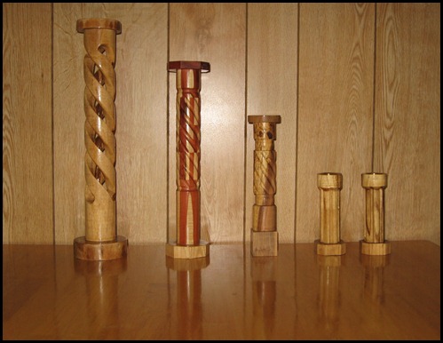
After not making any candleholders for some time I can’t seem to quit making them now.  Since my last post I have turned a few more on my Craftsman Router Crafter.

IMG_1147


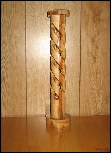
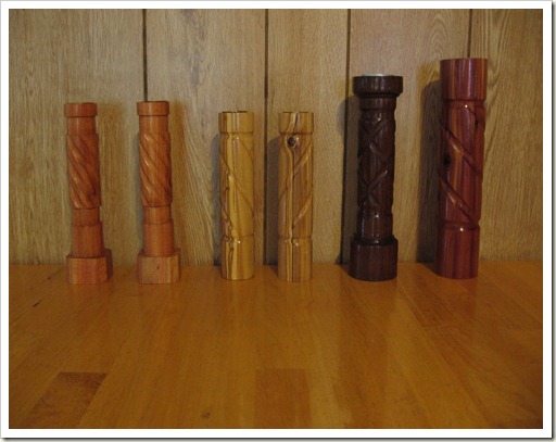
The hollow spiral on the left was made from a piece of oak firewood.  It stands 16 inches tall and allows for a large pillar candle to be placed on top.  Here is a close-up photo.

IMG_1161


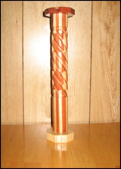
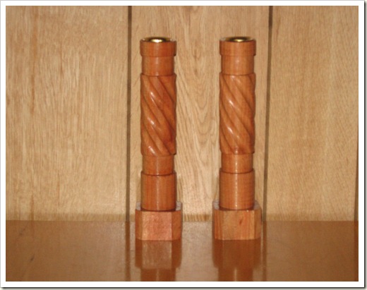
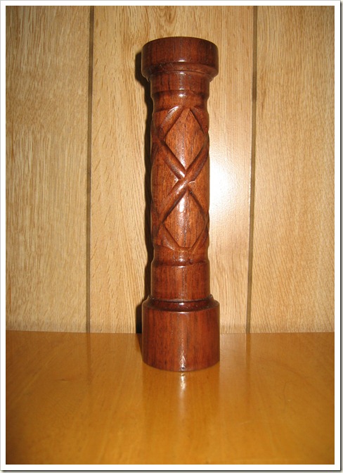
The second from the left, pictured above, is made from Eastern Red Cedar and oak.  This was the first time I tried laminating two species together and then turning them.  Here is another photo of this 13 inch candleholder.

IMG_1162


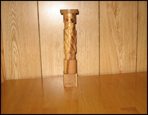
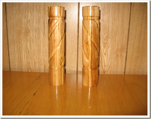
The third candleholder from the left is made from a piece of dogwood.  The piece had an unusual light portion running down the center of the limb.  This piece is about 9-1/2 inches tall.  Here is a picture of it by itself.

IMG_1165
The final set on the right are turned from the Mimosa (Silk Tree) that grows about everywhere here in Kentucky.  These are small, only about 5-1/2 inches tall.

IMG_1167

Maybe I’ll find something else to do for awhile.

Read more...

More Candleholders

>> Sunday, September 2, 2012


Busy with everything else it seems, I had not ventured into the shop to turn any candleholders for quite some time.  Below are pictured ones that I made on my Craftsman Router Crafter.

IMG_1131
The above photo is rather dark, so below are individual pictures.

IMG_1137


This set is made from carob wood brought from California.  It has a beautiful red color.

IMG_1122


These are also made from wood brought from California, olive wood.  This wood is very hard and heavy.  I believe the grain is quite beautiful.

IMG_1118


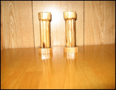
This is another black walnut candleholder made from the old sill log I got from under the old house I tore down a couple of years ago.  It is drilled for a tea light candle.

IMG_1113


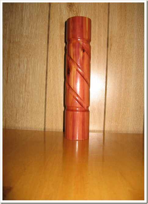
And, finally, another Eastern Red Cedar candleholder.

Read more...

Our 48th Wedding Anniversary

>> Tuesday, July 31, 2012


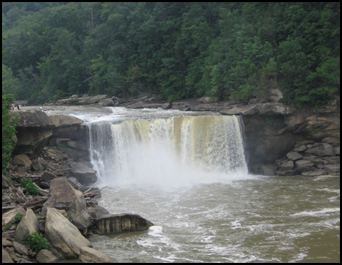
On July 19, 2012 Connie and I celebrated our 48th wedding anniversary.  We got away for a couple of days.  On the 18th we drove over to Cumberland Falls State Park for a return visit to the falls.  We had been there about 5 years ago and although we enjoyed it very much, the water in the river was quite low and there was not enough water going over the falls to fully cover all of the rocks.  We had kept promising ourselves we would go back.  So, finally we made it.  Although the summer has been quite dry there had been some rain in the local area that had the river running at normal levels.

IMG_0933


The falls is 125 feet wide and 68 feet tall at normal pool.  If you look closely you can see several people on the left of the falls.  This will give you a bit of an idea of the size.  The falls is referred to as the “Niagara of the South,” as it is the largest waterfall south of Niagara and east of the Mississippi river.

There is one thing that occurs here and in no other place in the entire western hemisphere.  Only at night during a full moon  one can see a “moon bow.”  This is much the same as a rainbow that is seen on most days but is an arc of white light.  We have never seen this but maybe sometime!

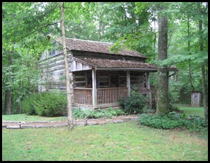
Leaving the falls we drove to near Knoxville, TN and spent the night.  We had made reservations at a unique “bed and breakfast.”  Here is a picture of the sign in front of the place.

IMG_0958We found the name of the place to be quite interesting since we live here “on Cedar Ridge.”  The cabin was moved to this location from about 3 or 4 miles away and was modernized.  It has central heat and air, a full bathroom and modern kitchen.  We opted out of the breakfast and took food and fixed our own—steak and eggs!


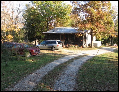
IMG_0953This picture is of the exterior of the cabin.  All of the logs in the walls are original.  The setting is very nice, quite a ways off of the main street and was very quiet and peaceful.  Below are a couple of photos of the inside of the cabin.


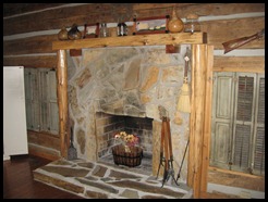
IMG_0945A very large and working fireplace is the central point in the  cabin.  Unseen in this photo is a nice sofa in front of the fireplace.  The white cabinet to the left in the photo is an entertainment center with TV and VCR.


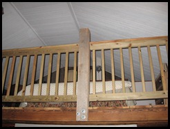
IMG_0948This picture was taken from in front of the fireplace, looking up into the loft where the king-size bed was located.  After a good breakfast the next morning, the 19th, we spent several hours at the Museum of Appalachia, which was virtually next door to the cabin.


The museum was founded by John Rice Irwin in 1969 with one log cabin.  It is now a non-profit organization and includes dozens of historic log structures and exhibit halls with thousands of authentic artifacts from the Appalachia area.  Mr. Irwin traveled the many back roads collecting these items, items used by and often made by the mountain folk of the Southern Appalachia area.

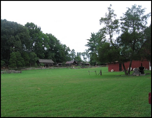
IMG_0962


The view above is of part of the 60 acre museum grounds. 

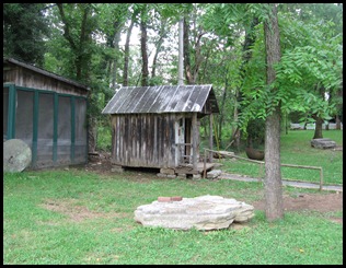
IMG_0966The tiny building in the photo to the left is the smallest dwelling  in the museum.  It was moved to the museum in 2007 from nearby Beard Valley, in Union County, TN.  This was the home of an old bachelor by the name of Tom Cassidy.  He is reported as saying,  “I’ve got that little cot in there, a chair, a stove for heat and cooking, a frying pan, a bean pot, on old dresser, my fiddle and my pistol;  what more does a man need?


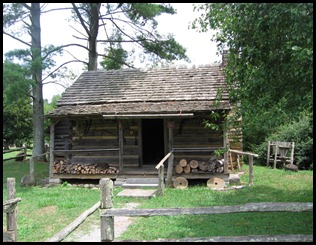
IMG_0973This cabin is known as the “Mark Twain Family Cabin.”  It was moved to the museum from Possum Trot, TN and once was the home of Mark Twain’s parents and some of their children.  Mark Twain (Samuel Clemons) was born 5 months after the family moved from Tennessee in 1835.


As I said, we spent several hours there but one could spend even more time looking at all of the interesting exhibits and reading the information that has been written about them.  We returned home that afternoon, having had an enjoyable break and a good anniversary.

Read more...

Our 33 Day, 6731 Mile Road Trip–part 13 Recap

>> Sunday, July 22, 2012


As the title says, Connie and I were gone from home for 33 days (and 32 nights).  We drove nearly 7000 miles, by actual odometer readings it was 6731 miles.  We crossed or drove through a portion of 17 states.  Including Kentucky, where we started and ended up, we drove through Kentucky, a corner of Indiana, across Illinois, Missouri, a small corner of Iowa, across Nebraska, Wyoming, part of Utah, across Idaho, through much of Oregon, into and back out of Washington, down through California, across Arizona,  New Mexico, Texas, Arkansas, and half way across Tennessee before getting back to Kentucky. 

Of the 32 nights we were gone from home we spent 10 nights at our son’s home, 8 nights with friends, 1 night in a motel and 13 nights we slept in our van.  9 of those nights were spent in the auto parking lot at “truck stops” or as they are called most often now, Travel Plazas.  1 night was spent in a Wal-Mart parking lot and 3 nights in campgrounds.

If we use the amount spent for a motel for the one night as an average figure the 13 nights spent in the the van saved us almost $1000.00.  I mentioned in part 1 that we tried to figure all the ways we could cut expenses.  One way we did that, in addition to sleeping in the van, was to invest in an America the Beautiful Senior Interagency Pass available for those over 62 years of age (and it is good for a lifetime).  The pass is $10.00 plus a fee of $10.00 when ordered by mail, as I did.  With the pass we were able to visit the Oregon Trail Interpretive Center and the 3 national parks for free.  Two of the campgrounds we stayed in were in national forests and we got 50% off of the normal fee.  By my calculations we saved about $85.00 after deducting the cost of the pass.

I had mentioned that gasoline would be our big expense.  The lowest price we paid was $3. 299 a gallon.  Most was in the $3.50 to $3.65 range.  It was much more expensive in California and parts of Oregon and Arizona.  The most we paid was at a station just outside of Yosemite National Park, and I only bought $20.00 worth.  Regular gasoline there was $5.099 a gallon.  When I figured everything up on our return I found that we paid an average of $3.82 a gallon.  Our van performed well and we averaged 24 miles per gallon for the trip.  I felt this was quite good considering we were driving 70 miles per hour on most of the interstates and we were driving in the mountains for many of the miles.

We thoroughly enjoyed our road trip but perhaps the most beautiful thing we saw was this.

IMG_0175


Yes, home sweet home.  (This photo was taken last Fall so we didn’t have the color change of the leaves greeting us on our return.)

Read more...

Our 33 Day, 6731 Mile Road Trip–part 12

>> Tuesday, July 17, 2012


I mentioned at the end of part 11 that we drove to Hondo, TX on day 27 of our road trip.  For the only night of our trip we had reserved a room at a motel.  As far as I could determine there was no truck stop in or near Hondo and since the temperature was quite warm we desired to have a good nights sleep and a shower before we began our busy day, May 19th.

We arose early and ate a bit of breakfast, then drove the 3 or 4 miles out of town to the Ruben Torres Unit.  We arrived a little before 8:00 A.M. and found that there were 15 or 20 vehicles already there waiting.  And, we all waited until 8:00 A.M. when the guards manning the guard shack began their shift.  Each vehicle went through the security check and was allowed to proceed to the parking area.  From there we were processed through the security entrance and moved on to the visitor area.  Finally, a little before 9:00 A.M. our actual visit with Juan began.

We had called earlier in the week and requested a 4 hour visit, the normal visit being just 2 hours.  That request was granted and the guard on duty in the visitor room situated us to the far corner, away from much of the noise of the contact visits.  Ours was a non-contact visit since we were not family.  We were not prepared for the visit to be by telephone, only being able to see Juan through the glass.  We had experienced that at the McConnell Unit last October but it was a maximum security unit.  However, we managed fine, except for the time a couple with small children or babies were seated just down the way from us.  The little ones made quite a bit of noise and even Juan could hear some of it through the phone.

Due to  the timing of an inmate count and the guard just not being strict with the time our 4 hour visit became 4 hours and 25 minutes.  And yet, it seemed to fly by.  The visit was about a 20 on a scale of 1 to 10.  All three of us enjoyed it greatly.

The man we visited at the McConnell Unit last Fall has been paroled and is living in the Austin, TX area.  We had contacted him and told him we planned to stop for a few minutes and see him.  We called him from the parking lot at the Torres Unit and let him know we were on the way.  About 2 and 1/2 hours later we were visiting with Robert at his niece’s home.  Our visit was short, only an hour or less, as we still had several miles to drive.

By about 7:15 P.M. we arrived in Bryan, TX at the home of Thomas and Raquel, the founders or Broken Vessels Prison Ministry.  They set some food before us and we enjoyed some good conversation before it was time for bed.

The next day, May 20th, the 29th day of our road trip, we were up and away early, driving to Navasota, TX to the Pack Unit where we spent most of the day.  We first visited Troy, who we had visited last Fall, for a bit over 4 hours.  We exited the unit, ate a sandwich in the parking lot, and reentered to visit with Wesley B.  Due to the timing we knew we wouldn’t be able to get in a full 4 hours with him, but due to his leg bothering him and needing to get back to his dorm we cut the visit short after about 2 and 1/2 hours or so.  Both visits were very good.

After returning to Bryan we accompanied Thomas and Raquel to the home of Rebecca, whom we had met last October.  What we didn’t know until we arrived in Bryan was that Rebecca had married Wayne a bit earlier in a civil ceremony and they were planning a “religious” ceremony while we were there.  As it turned out I got to walk the bride down the “aisle.”  I put that in quotes as the ceremony took place at the picnic area at Lake Bryan.  But, I’m getting ahead of the story.

Wesley T., that we had met last Fall, lives in the trailer park that Rebecca manages so we were able to see him and visit a bit that evening.  Of course we got to meet Wayne and we all enjoyed a bit of food together.

The next day was a bit of a relaxing day.  Connie and I spent a couple of hours with Wesley T. in the morning before he had to go to work and then just rested most of the rest of the day.

May 22nd, our 31st day, was busier.  We all had to drive out to the lake and help get things prepare for the wedding service.  Everything went well and following the ceremony we all enjoyed a good meal that had been prepared by some of the wedding parties relatives.  A little later Thomas, Raquel, Connie and I had the privilege of baptizing Wesley T. in the lake.

May 23rd Connie and I headed on toward Kentucky.  We had a good day, driving about 560 miles.  We spent the night at the Flying J Travel Plaza in West Memphis, AR.  The following day, May 24th, our 33rd on the road we drove the rest of the way home.  We arrived home by about 2:00 P.M.  It was good to be greeted by 4 enthusiastic grandchildren and their parents.  We felt like maybe we had been missed a little bit while we were gone.

I’ll bring this whole story to an end in the next part as I try to recap and summarize a bit.

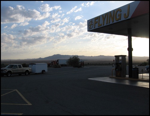
IMG_0883This picture was taken at the Flying J in West Memphis, AR

Read more...

Our 33 Day, 6731 Mile Road Trip–part 11

>> Tuesday, July 10, 2012


Following our visit with friends in Cottonwood, AZ we were back on the road on May 16th, day 25 of our road trip.  We had no further plans to visit national parks or scenic areas but were headed to Texas.  As I posted last November Connie and I had become a part of Broken Vessels, a prison ministry.  Our intent was to visit some of the fellows we had been writing to behind the razor wire as well as spend some time with Thomas and Raquel, the founders of the ministry.

Before we left our friend’s home they tried to show us on the map and tell us of possible routes we could take to avoid Phoenix.  However, I felt that based on the time we were getting onto the road and the distance we had to travel that we would arrive in the Phoenix area in late morning, well past the morning rush hour.  And, that proved out to be true.  Even though there are 6 lanes of traffic each direction in parts of the city we did not experience any major difficulties.

We had checked the Pilot Travel Centers/Flying J directory found in the back of each months issue of Challenge Magazine (which can be picked up free at any Pilot or Flying J location) and had made Lordsburg, New Mexico our goal for the night.  There was a quite nice Flying J there.    The picture below was taken the following morning before leaving.

IMG_0874

Day 26 of our trip, May 17th, we travelled on toward Texas and actually got into the big state about mid-day.  We drove about 400 miles that day, stopping for the night in Fort Stockton, TX  There was no Pilot or Flying J close but the Kwik KIng, Oasis Travel Center in Fort Stockton was quite nice.  Shortly after arriving we got to see something of interest.

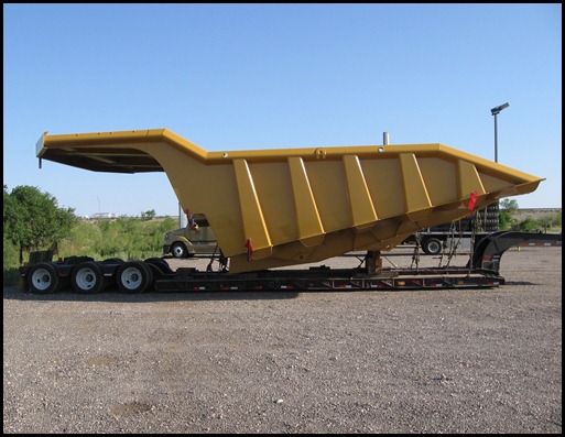
A truck pulling a low-boy carrying a wide–load pulled into the truck lot, and I mean a wide, wide load.  It was of interest because of what that load was.  On that low-boy was the bed of one of the large mine trucks like we had seen at the Borax mine in California.  I was able to walk over and take a couple of pictures.  You can see the huge size much better than trying to picture in your mind what a truck bed 25 feet wide and 45 feet long looks like.  One of the escort vehicle drivers told me they were headed to a testing facility in Arizona.

IMG_0875


The following day, day 27 of our trip, May 18th, we drove the remaining 300 miles or so to Hondo, TX, our goal for the day.  In part 12 I’ll tell you of our visits in Texas.

Read more...

Our 33 Day, 6731 Mile Road Trip–part 10

>> Friday, June 29, 2012


After spending a couple of nights and a day with a friend, as mentioned in part 9, we got back on the road May 13th, the 22nd day of our road trip.  The goal for the day was to reach a campground near Grand Canyon National Park.  One thing that we anticipated when leaving California was that we would be leaving Pacific Daylight Savings Time and would be entering Mountain Time zone.  We were changing our watches, etc. but discovered a bit later that the state of Arizona does not change to Daylight Savings Time, consequently the time on the clock was the same as what we had been on in the Pacific Daylight Savings Time.

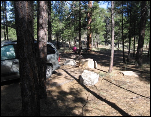
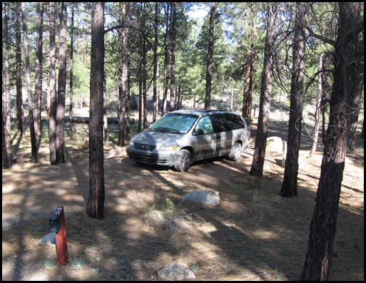
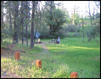
We arrived at the Ten-X campground just a few miles from the park entrance about 4:30 P.M.  We found the campground to be very nice.  There are 70 camping spots and they are spread out so that one does not have extremely close neighbors.  Here are a couple of photos of our camp spot.

IMG_0778


IMG_0776


In the photo of our van you can see that the windshield and side windows are covered, but since there was nobody camped behind us we did not cover the back window.  We were able to look right up at the stars, and there were lots of them.

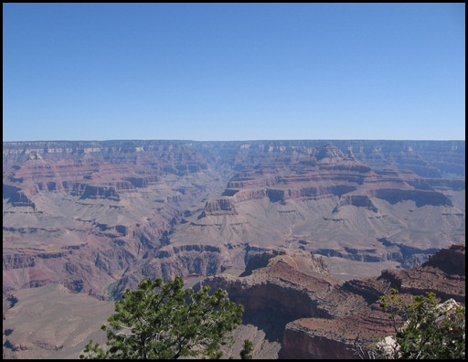
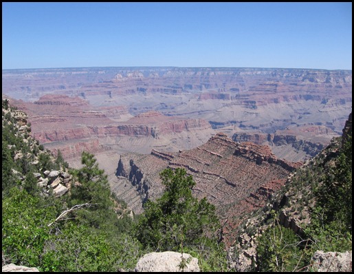
After our breakfast the next morning, May 14th, our 23rd day of our trip, we were off to the canyon.  We have visited the canyon at least three previous times, the last time being in October of 1988.  Even though one may visit numerous times it is still awe inspiring.  Connie and I both took a lot of photos, it was hard to know when to quit.  All of them are impressive in their own way and it is hard to choose only 2 or 3 to post here, but here are some.

IMG_0783


IMG_0797


IMG_0811


Once we completed the drive along the south rim of the canyon we headed on back south. 

We have friends living in Cottonwood, AZ and had made arrangements to spend a couple of nights and a day with them.  We had a very good visit with them.  In the next post we will continue the story of our 33 day road trip.

Read more...

Our 33 Day, 6731 Mile Road Trip–part 9

>> Tuesday, June 26, 2012


As I mentioned at the end of part 8 we stopped for the night on May 10th, the 19th day of our trip,  at a county campground in Lone Pine, California.  Portagee Joe Campground is just outside the city of Lone Pine in Inyo County and lies to the east of Mt. Whitney.  Although Mt. Whitney is taller than Mt. Shasta that we posted a picture of in part 7 it did not appear that way since there was no snow visible. 

I had a few questions about this campground that I did not get answers to until I returned home and did some research on the internet.  There was a sign at the campground stating that the property was leased to Inyo County by the City of Los Angeles.  How was that? 

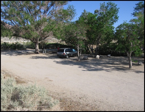
There was a small stream that flowed through the campground and I wondered where the water came from since this was desert.  I discovered that it seemed to originate under a “concrete river.”  What was that ?  I’ll explain a bit of what I discovered after I post a photo of the campground and our camping spot.

IMG_0741


What I discovered rather gave me the answer to both questions.  The City of Los Angeles acquired the property when the first of two aqueducts were built (the first one 1908-1913 and the second 1965-1970) to bring water from the Owens Valley to Los Angeles.  This created about as many problems as it solved and can be some interesting reading if one has an interest.  Anyway, the “concrete river” right up behind the campground is one of the aqueducts.

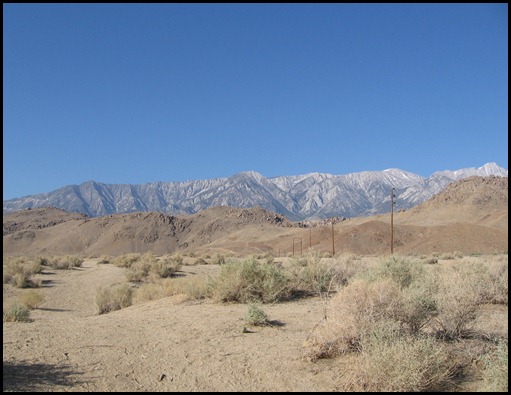
IMG_0740


This picture was taken looking right up from the campground.  Mt. Whitney is in this chain of mountains.  The aqueduct is right over the near rise, close to the power poles.

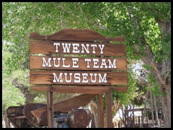
On day 20 of our trip we continued on South.  Having looked at a free magazine that I picked up (Scenic 395  The Official Guide) I found an interesting article on the borax mine at Boron, California which was only about 6 miles off of our route.  We drove over to Boron and first stopped at the 20 Mule Team Museum which contains a lot of interesting displays and information on the mining of borax, beginning with the mining that began in Death Valley. 

IMG_0745
We didn’t take photos in the museum but I snapped this shot of the sign out in front of the building.  After our visit here we headed out of town about 3 miles to the borax mine.


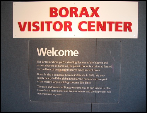
IMG_0756


You may or may not be able to read what was printed on the sign outside the visitor center but it states that this site is one of the biggest and richest deposits of borax on the planet and the mine supplies nearly one half of the world’s need for borax.  First begun in the 1920’s as an underground mine it was converted to an open pit mine in 1957.

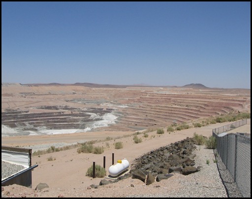
IMG_0758


This view is from the visitor center of the mine pit.  Barely discernible in this photo in one of the large mine trucks hauling ore up and out of the pit.

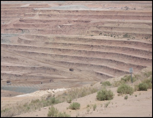
IMG_0764


This shot was a zoomed in view of the truck and it still is hard to see, yet it is a huge truck.  The capacity of the truck is 255 tons, the truck bed is 46 feet long and 25 feet wide.  The tires are 11 feet tall (and cost $40,000.00 each!)  It has  a 2500 horsepower diesel engine that drives an alternator that powers 2 rear electric wheel motors.  Maximum speed is about 30 miles per hour but when hauling ore it moves only 3 to 5 m.p.h.

After leaving the mine we drove on south another 50 or 60 miles and spent a couple of nights and a day with a friend we have known for over 50 years.  In our next installment we’ll take you with us as we get back “on the road.”

Read more...

Our 33 Day, 6731 Mile Road Trip–part 8

>> Wednesday, June 20, 2012


The goal for May 9th, the 18th day of our road trip, was Yosemite National Park.  As we neared the park we stopped at the Groveland Ranger Station to check on available campsites in the National Forest, outside of the park.  We were told that there were plenty of campsites available in all of the campgrounds so we decided to drive on another 12-15 miles to the Sweetwater Campground.  This campground was only about 10 miles from the part entrance.  We paid for and marked our campsite and drove on to the park.

IMG_4634We entered the park at the Big Oak Flat Entrance.  We drove to Yosemite Valley as many of the famous sites can be seen there.  We were last at Yosemite over 47 years ago.  The mountains and waterfalls haven’t changed much but there have been a lot of changes to the roads, etc. due to a much higher number of visitors.  Where roads had been 2 way, 2 lane roads they are now one way roads.  Yosemite Village was something we remembered from our previous visits and thought we would stop there.  However, the signs told us that there was a 10 minute walk from the parking lot so we decided to pass on that.  Here are a few pictures of some of the things that have remained much the same.

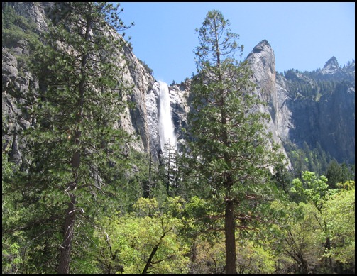
IMG_0701


There are a number of spectacular waterfalls at Yosemite.  This is one of the first ones we saw after entering Yosemite Valley.

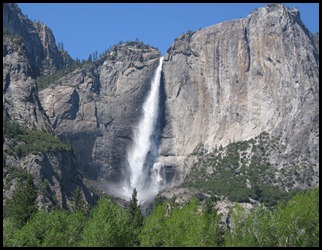
IMG_0712This is Upper Yosemite Falls.  It is the larger and more spectacular of the upper and lower falls.


IMG_0722
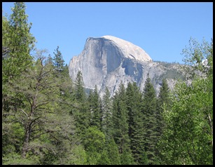
This is Half Dome.  If you have seen any photos of Yosemite you probably have seen a picture of Half Dome.  After spending some amount of time in the valley we headed back to our campsite, where we spent a relaxing evening.


IMG_0727This photo was taken from the parking area where we parked our van.  Behind the trees on the left in the picture you can make out a large metal box.  That was our bear locker.  All food items and cooking material were to be placed in the box overnight to keep bears from raiding.  Thankfully we didn’t see any bears but we put our items in the box.

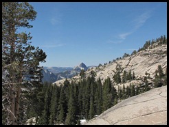
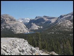
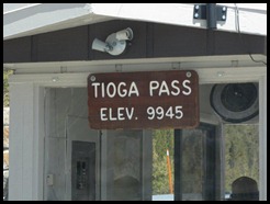
We had originally thought we would drive across the park and over Tioga Pass and drive down US 395 but all reports indicated that the road over the pass was closed due to winter snows.  However, when we got in the area we began to see signs that Tioga Pass was open.  In fact it opened on Monday and we were able to cross on Thursday, May 10th.  Here are a few photos taken as we drove across. 

IMG_4789
This is another view of Half Dome—the back side—taken from Rt. 20 as we crossed the park.


IMG_4797This pix is of some of the beautiful scenery along this route.


IMG_4826

Just to prove that we actually did cross Tioga Pass Connie snapped this shot as we were stopped at the booth prior to exiting the park.  We still had a lot of downhill driving to do to get us down to US 395.


We drove south on US 395 and stopped for the night at a county campground in Lone Pine, California.  More about that in our next installment.

Read more...

Our 33 Day, 6731 Mile Road Trip–part 7

>> Saturday, June 16, 2012


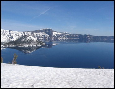
When we first began planning our trip we had discussed the possibility of visiting Crater Lake National Park.  But, everything I read indicated that the roads coming from the north and or northwest would possibly still have snow.  And, as I checked on-line I found that the road around the lake had only a limited area open.  But, all reports were that the weather was nice so we decided we would make that side trip.  We left our son’s home about noon of May 7th, the 16th day of our road trip and drove south to Central Point, Oregon where we spent the night at a Pilot Travel Center.

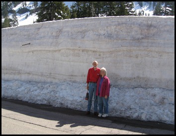
By 7:00 A.M. the next morning we were on the way to Crater Lake.  We stopped a few miles further along by a rushing mountain stream to eat our breakfast.  As we neared the park we began seeing huge piles of snow that had been pushed off of the highway.  We found that there was still a lot of snow at Crater Lake and that was why much of the road around the park was closed.  They feel good if they have the road open all the way around the lake by the 4th of July.  It is a big job removing the average 44 feet of snow they receive each winter.

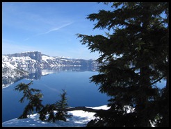
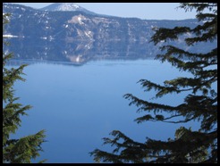
We had to climb over the snow banks to get to where we could view the lake.  We felt blessed because at least 50% of the time in winter and spring one can not see the lake for clouds and fog.  Here are a couple of photos of the lake.

IMG_0654


IMG_0669IMG_0672


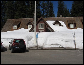
We hadn’t stopped by the visitor’s center at the park on the way in so decided to do so on our way back out.  The ranger we talked to said that they didn’t have a lot of snow left.  To us it looked as if they did.  This picture was taken in the parking lot of the visitor’s center—the snow was in the middle of the lot.

IMG_0681


We were unable to use the main entrance to the visitor’s center as it was still blocked by snow.  We were told that during the winter the snow is completely over the top of the building.

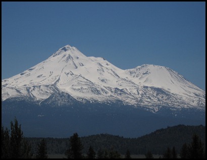
IMG_0682After leaving the park we headed on our way toward California.  By traveling south-southwest we were able to get back to I-5 at Weed, California.  On the way we were in sight of Mt. Shasta for many miles.  Mt. Shasta is 14,162 feet above sea level and 11,000 feet from it’s base to the summit.


IMG_0686


We stopped for the night of this our 17th day of our road trip at the Pilot Travel Center in Dunnigan, California, just north of Sacramento.  The next day we headed for Yosemite National Park—we’ll cover that in the next installment.

Read more...

Our 33 Day, 6731 Mile Road Trip–part 6

>> Thursday, June 14, 2012


We arrived at our son’s home the afternoon of our 6th day, April 27th and stayed until about noon of May 7th, our 16th day.  During this time we visited several interesting places within driving distance of Salem. Oregon.

One day we took a drive to see several historic covered bridges, taking along a picnic lunch.  The first two were in the town of Sweet Home, Oregon.  Both are pictured below.
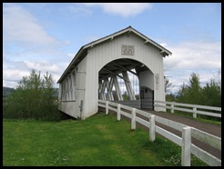
IMG_0586This is the Weddle Bridge at Sweet Home, Oregon.  Although the bridge is no longer in use by vehicles one is able to walk across.  There is now a park at this location and it was here that we ate our picnic lunch.
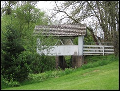


IMG_0588This small bridge is just a few feet away from the Weddle Bridge pictured above.  It was built for pedestrian traffic but it is closed to all traffic now.  It is the Dahrenburg Bridge.
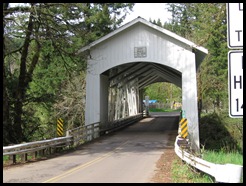


IMG_0592The Short Bridge, as it is called, is still in regular use, being used to span the South Santiam.  This bridge is about 12 miles east of Sweet Home, Oregon.
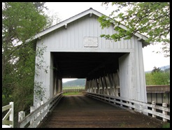


IMG_0599The Crawfordsville Bridge spans the Calapooya River and it also is closed to vehicular traffic.  It is located at the west end of Crawfordsville, Oregon beside Hwy. 228.


On another day we spent a few hours at the Willamette Heritage Center at the Mill in Salem, Oregon.  The following information is taken from their web site.

“A visit to the Willamette Heritage Center at The Mill is a stroll through the history of the Willamette Valley. The five-acre campus is home to fourteen historic structures that present the stories and richness of Oregon's past.

Pioneer buildings at the Willamette Heritage Center at The Mill take visitors back to the early settlement of western Oregon. The 1841 Jason Lee House, arguably the oldest standing wooden frame house in Oregon, pre-dates the first wagon trains crossing the Oregon Trail. These structures provide a glimpse into the lives of the missionaries and pioneering families when these early founders were putting down roots in the Valley.

The 1895 Thomas Kay Woolen Mill, one of the best-preserved Victorian-Age factories in the West and designated an American Treasure by the National Park Service, vividly tells the story of industrialization in the West.”


I especially enjoyed the tour through the mill.  Even though it has been closed since 1962 all of the machinery is still in place and the tour guide did a great job explaining the entire process of taking the wool fleece and turning it into woolen blanket material. 
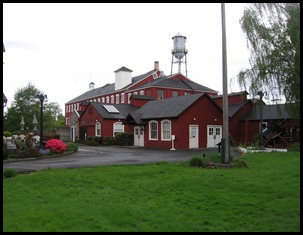
IMG_0615This photo is of the Thomas Kay Woolen Mill.  The mill was in operation from 1889-1962.  The original mill burned in 1896 and was replaced with this brick building.  The entire mill was powered by water power, which turned a turbine.  A set of crown gears transferred the motion from the vertical turbine to a horizontal shaft that powered all of the machinery in the main mill.

One thing that Connie desired to do while in Oregon was go to the coast.  So, one day was spent driving to the coast, driving up the coast and driving back to Salem.  One of the first spots we visited was the historical Yaquina Bay Lighthouse.  It was only in operation for three years, 1871-1874.  The lighthouse lamps burned whale oil and could be seen for 12 miles.
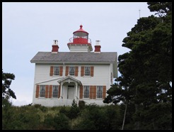
IMG_0627The Yaquina Bay Lighthouse was the only lighthouse in Oregon that provided living quarters for the lighthouse keeper and his family.  A larger lighthouse with a light that could be seen for 22 miles was built only 3 miles away and forced the decommissioning of this one.
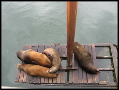


IMG_0638Just a short distance from the lighthouse, in the town of Newport,  we were able to view these California Sea Lions.  These are all males.  The females never leave the waters of California and the males return during the mating season, spending the rest of their time along the Oregon coast.


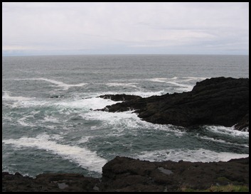
We stopped along the coast for our picnic lunch at a popular whale watching site.  We looked but never saw any whales.  Our son said that on previous trips he had seen a few.  Here is a picture of the Pacific along the Oregon coast.
IMG_0643


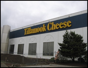
To conclude the visit to Oregon’s coast we stopped at the famous Tillamook Cheese factory at Tillamook, Oregon.  They seem to be known for their ice cream as well and we all had to try one of their cones before heading back to Salem.
IMG_0650

Read more...
  © Blogger template Sunset by Ourblogtemplates.com 2008

Back to TOP